By allowing ads to appear on this site, you support the local businesses who, in turn, support great journalism.
Frigid weekend ahead
Temps to dip well below freezing
ICY FOUNTAIN 2
In this January, 2015, file photo, the fountain in front of Hendley Properties' The Fountain at Mulberry apartment complex is shown after a deep freeze. Similar frigid weather is expected to affect the area this weekend. - photo by JASON WERMERS/Herald file

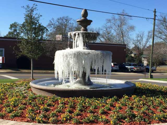
It’s going to get cold — really, really cold — this weekend.

The chance for freezing rain or even snow around Bulloch County on Friday night and Saturday morning is slim, but rain is definitely in the forecast. The National Weather Service website (www.noaa.gov) predicts a 40 percent chance of rain Friday and a 70 percent chance Saturday, but the really cold weather won’t arrive until later in the weekend, said Bulloch County Public Safety Director Ted Wynn.

“The low pressure will track off the coast Friday night into Saturday night as arctic high pressure builds from the northwest,” Wynn said in an email sent to county employees Thursday. “Some wintry precipitation is possible late Friday night and Saturday as colder air moves into the area. Then, very cold air and breezy conditions could cause low wind chills Sunday and Monday mornings.”

He reminds residents to drip their pipes, bring in plants and tuck pets safely indoors, as well as to “check on those who may have a problem keeping warm,” as temperatures will drop into the low 20s, with wind chill factors even lower by Saturday night.

Sunday morning’s low will be around 26 degrees, while it will be even lower at 23 degrees Monday, he said.

The rain Friday and Saturday could change to sleet and/or snow and will most likely impact Screven and Jenkins counties more than Bulloch and other counties further south. 

Wynn warned drivers of the possibility of “a small glaze of freezing rain on bridges and overpasses, perhaps also on trees and power lines.” However, “little to no snow and sleet accumulation is expected,” he said.

The National Weather Service predicted the possibility of wind chills as low as 15 degrees Sunday and Monday, but with sunny conditions.

The weather should return to normal by Tuesday, with a high in the mid-50s, Wynn said. By Thursday, the National Weather Service predicts the high will approach the upper 60s.


Herald reporter Holli Deal Saxon may be reached at (912) 489-9414.