
RALEIGH, N.C. — After bringing rains, heavy winds and even tornadoes to parts of Florida, Tropical Storm Andrea moved quickly across south Georgia and was speeding through the Carolinas on Friday morning, promising sloppy commutes and waterlogged vacation getaways through the beginning of the weekend.
The first named storm of the Atlantic season lost some intensity after making landfall Thursday in Florida's Big Bend and its winds were down to 45 mph (75 kph) Friday.
Ben Nelson, a meteorologist with the National Weather Service in Jacksonville, Fla., said Andrea was "moving at a pretty brisk pace" and could lose its tropical characteristics Friday.
During the morning rush hour in Charleston, S.C., there was little evidence the center of the storm was passing to the northwest beyond a few downed tree branches, gusty winds and some puddles in the street. The sun occasionally peeked through.
Derrec Becker with the South Carolina Emergency Management Division said the storm was moving northeast at nearly 30 mph. Across the state, he said, Andrea has brought nothing more than a severe thunderstorm. No injuries were reported and there had been no reports of significant damage.
The storm was expected to move into North Carolina by midday.
The National Weather Service issued flood watches across much of both states, as well as tornado and flash flood watches in several counties.
Thousands of power outages were also reported.
Tropical storm warnings remained in effect for the East Coast from the South Santee River in South Carolina to Cape Charles Light in Virginia, the Pamlico and Albemarle sounds and the lower Chesapeake Bay south of New Point Comfort. A tropical storm warning means tropical storm conditions are expected somewhere inside the warning area within a day and a half.
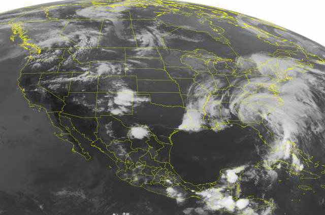
As of 11 a.m. EDT Friday, Andrea was centered about 50 miles (85 kilometers) southwest of Fayetteville, N.C., with little change in strength expected.
Rains and winds from the storm were forecast to sweep northward along the Southeastern U.S. coast Friday.
Florida Gov. Rick Scott had warned of the risk of tornadoes, and officials said that eight were confirmed across the state.
"This one fortunately is a fast-moving storm," he said Thursday. Slower-moving storms can pose a greater flood risk because they have more time to linger and dump rain.
In The Acreage, a part of Palm Beach County, Fla., prekindergarten teacher Maria Cristina Arias choked back tears and clutched valuable personal papers as she surveyed the damage done by a tornado to her five-bedroom home when she was away. Windows were smashed and a neighbor's shed had crashed into her bedroom.
"It's all destroyed," she told The Palm Beach Post. "This is unbelievable. I don't know what we're going to do."
Her 19-year-old son, Christian, was sleeping when he heard a loud noise.
"It was really scary," said the teen, who wasn't hurt. "It sounded like something exploded. I didn't know what was going on."
In the Carolinas, Andrea's biggest threat was heavy rain, with as much as 6 inches expected, the weather service said.
Forecasters didn't expect major problems, however, along the most vulnerable parts of the coast such as the Outer Banks, a popular tourist destination.
John Elardo, a meteorologist with the weather service in Newport, N.C., said the storm would push major waves to the north and northeast, away from the Outer Banks, where storms in the fall and winter wore away dunes and washed out portions of North Carolina Highway 12, the only road connecting the barrier island to the mainland of North Carolina.
Andrea could bring up to a foot of flooding on the sound side of the Outer Banks, Elardo said.
The rain threatened to ruin a beach day for Angela Hursh, 41, of Cincinnati, who had rented a house in Frisco, N.C. Hursh was planning Friday to soak in the hot tub and watch movies with her 9-year-old and 13-year-old daughters.
"I think we're just going to hunker down and eat junk food," Hursh said Thursday.
Doug Brindley, who owns a vacation lodging rental service on the northern end of the Outer Banks near Virginia, said Thursday he expects all outdoor activities to be washed out Friday, driving tens of thousands of early summer vacationers toward unexpected shopping sprees.
"We're going to have rain and wind," said Brindley, who owns Brindley Beach Vacations and Sales. "Retailers are going to love it."
In Cuba, days of torrential rains associated with Andrea caused rivers to jump their banks in the western province of Pinar del Rio. More than 3,300 people evacuated endangered homes, and nearly 1,000 acres (4,000 hectares) of croplands suffered "serious damage," state-run newspaper Juventud Rebelde said Friday. Rain was forecast to continue falling on already-waterlogged areas through Saturday.
___
Smith reported from Charleston, S.C. Contributing to this report were Associated Press writers Jack Jones in Columbia, S.C.; Jennifer Kay in Miami; Gary Fineout and Brent Kallestad in Tallahassee, Fla.; Peter Orsi in Havana; and Emery P. Dalesio in Raleigh, N.C.